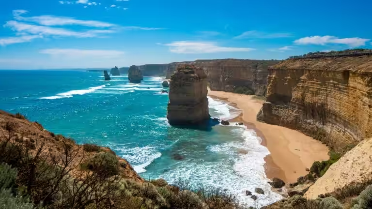
Cyclone Warning for WA’s Midwest-Gascoyne and Pilbara area
Department of Fire and Emergency Services WA has issued a Cyclone Advice for people in or near Onslow to Jurien Bay in the Midwest-Gascoyne, Pilbara. The advice from FESWA is “if you live or are travelling between Onslow and Jurien…
Department of Fire and Emergency Services WA has issued a Cyclone Advice for people in or near Onslow to Jurien Bay in the Midwest-Gascoyne, Pilbara.
The advice from FESWA is “if you live or are travelling between Onslow and Jurien Bay in the Midwest Gascoyne and Pilbara, you need to prepare your home and family for a cyclone tracking off the Western Australian coast.”
“Cyclones can be incredibly dangerous, bringing heavy rain, flooding, gales and ocean swells. Heavy rainfall can also affect roads, making travel difficult or even unsafe. Some roads may be closed for a period of time.”
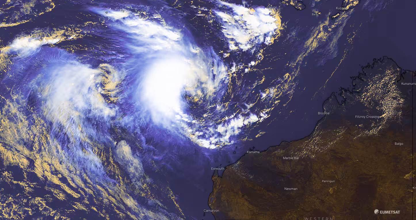
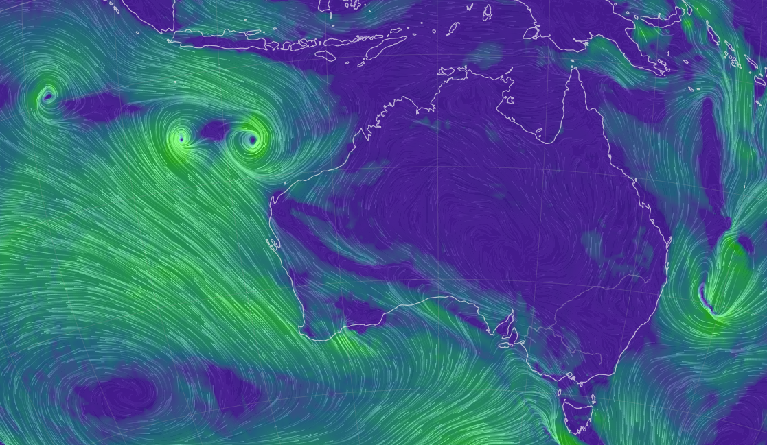
Tropical Cyclone Seroja is considered unusual as it has been brewing off the coast of Western Australia and has now been joined by two other tropical lows nearby. Two of the systems are on track to interact with one another over the next couple of days in a rare phenomenon known as the Fujiwhara Effect, adding to an already rare weather event.
According to the Bureau of Meteorology, Cyclone Seroja “is expected to bring a relatively brief but intense period of dangerous weather to the west coast of WA late on Sunday or on Monday, somewhere between Perth and Coral Bay, most likely between Jurien Bay and Carnarvon.”
Two cyclones are expected to merge into a single system and track towards the south. (pic BOM and Windy app)
“This is a rare event for people on the west coast of WA.”
“Tropical Cyclone Seroja is forecast to strengthen as it tracks to the southwest over open waters, north of Western Australia. During Saturday it is expected to take a more southerly track while remaining well offshore from the west coast.”
“On Sunday it is expected to turn to the southeast towards the west coast and make landfall most likely later Sunday or Monday between Coral Bay and Perth. There is likely to be destructive winds, very heavy rainfall and higher than normal tides close to Seroja’s path.”
“The strongest winds will be just to the north of Seroja’s track. The most intense rainfall, with the associated danger of flash flooding, will be just to the south of Seroja’s track.”
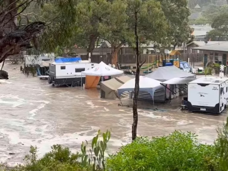
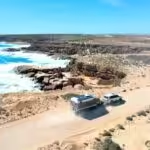
People who are travelling or planning to travel through the area, on land or offshore, need to stay informed and make a plan so they know exactly what to do if the situation gets worse. In fact, if you’re in a caravan or camping in a tent you should consider leaving the area now.
WHAT TO DO (from BOM):
Holidaymakers and people travelling through the area should speak with their accommodation provider about their cyclone plan and decide what they will do if the cyclone will impact the area.
If you do decide to leave the area, plan to do so early. The North West Coastal Highway, south of Minilya, is undergoing repairs and forecast rain may lead to this route being closed.
Do not drive into water of unknown depth and current. If the road is closed, it means it’s closed.
Take care in areas that have been flooded and be careful driving on gravel roads as surfaces will be slippery and muddy, and vehicles could become bogged.
DETAILS (from BOM):
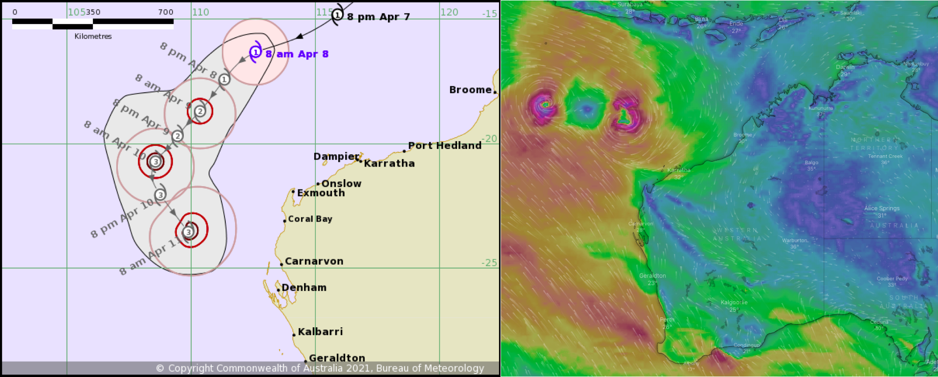
As at 9 am, the Bureau of Meteorology advised Tropical Cyclone Seroja (Category 1) was located 670 kilometres northwest of Karratha and 650 kilometres north northwest of Exmouth and moving southwest at 29 kilometres per hour.
Seroja is expected to bring a relatively brief but intense period of dangerous weather to the west coast of WA late on Sunday or on Monday, somewhere between Perth and Coral Bay, most likely between Jurien Bay and Carnarvon. This is a rare event for people on the west coast of WA.
Tropical Cyclone Seroja is forecast to strengthen as it tracks to the southwest over open waters, north of Western Australia. During Saturday it is expected to take a more southerly track while remaining well offshore from the west coast.
On Sunday it is expected to turn to the southeast towards the west coast and make landfall most likely later Sunday or Monday between Coral Bay and Perth. There is likely to be destructive winds, very heavy rainfall and higher than normal tides close to Seroja’s path.
The strongest winds will be just to the north of Seroja’s track. The most intense rainfall, with the associated danger of flash flooding, will be just to the south of Seroja’s track.
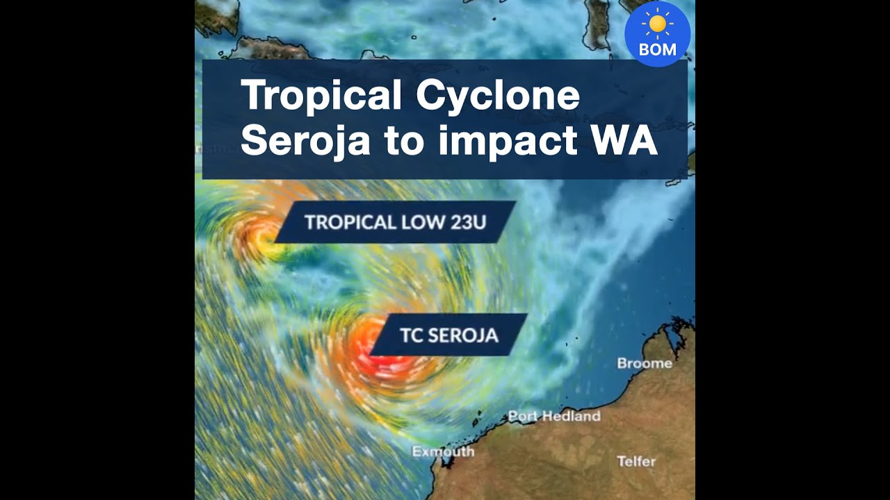
A Tropical Low (23U) was located 600 kilometres south of Christmas Island and 1,120 kilometres north-west of Exmouth and slow-moving.
Tropical low (23U) is slow-moving well to the northwest of the WA mainland. It is expected to move in a northeasterly direction during Thursday. It is possible for the low to strengthen to tropical cyclone intensity late Thursday or on Friday morning as it starts to move towards the east.
There is likely to be interaction between 23U and the approaching Tropical Cyclone Seroja which is expected to limit development of 23U.
Over the weekend the tropical low should move rapidly towards the south and could pass near the west Pilbara coast. There is the risk of a period of damaging winds and heavy rain developing in the Exmouth area as early as Saturday, even though 23U is unlikely to still be at tropical cyclone intensity by this stage.
It is rare to see three systems interacting as these are expected to do (pic: Earth Global Map).
IMPORTANT NUMBERS:
For State Emergency Service (SES) assistance call 132 500.
In a life-threatening situation call 000.
For weather information visit www.bom.gov.au or call 1300 659 210.