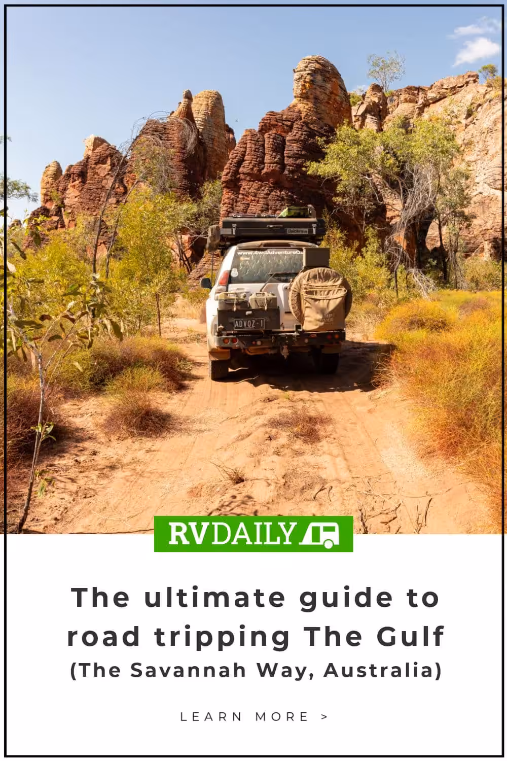
The ultimate guide to road tripping The Gulf
From Normanton in QLD to Mataranka in the NT, Glenn Marshall shares what to expect on one epic adventure exploring The Gulf of Australia.
Last Updated: 6 March 2024
From Normanton in Queensland to Mataranka in the Northern Territory, Glenn Marshall shares with us an alternate section of The Savannah Way and what to expect on one epic adventure exploring The Gulf of Australia.
Normanton is a top place to spend a few days before heading into the NT via Hells Gate. There’s plenty to see and do, plus some excellent free camping options along the Norman River. It’s worth checking out the Purple Pub or the Central Hotel for their restaurant-quality food, or try the Albion Hotel which has a great deck. Come morning, try the Green Room Cafe, which serves the best breakfasts and coffees this side of the black stump.
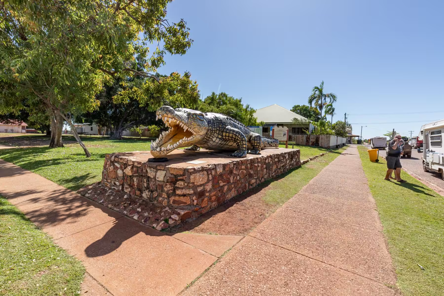
Krys the Crocodile is a photo opportunity, and you may spot a live saltie when exploring the Mutton Hole Wetlands Conservation Park. The Gulflander train terminates at Normanton, and you can jump aboard for a half-day trip out to Critters Camp or the Classic Experience to Croydon, spending the night at the historic Croydon Club Hotel.
Burke and Wills Camp 119 is 40km out of Normanton. It was a discrepancy with their compass that put them 50km out from where they thought, and that’s why they couldn’t reach the ocean. The campsite is 2km off the road via a maintained gravel road, and information boards explain the tragic trip.
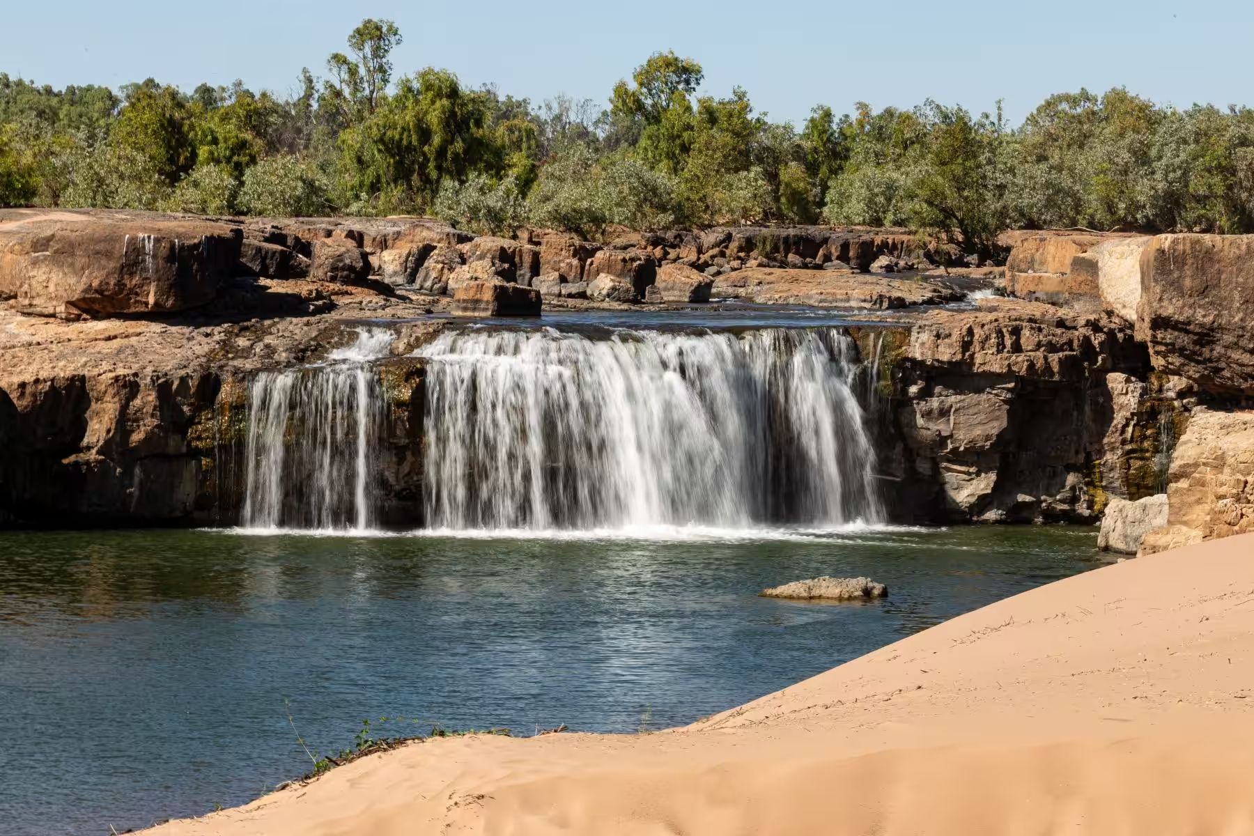
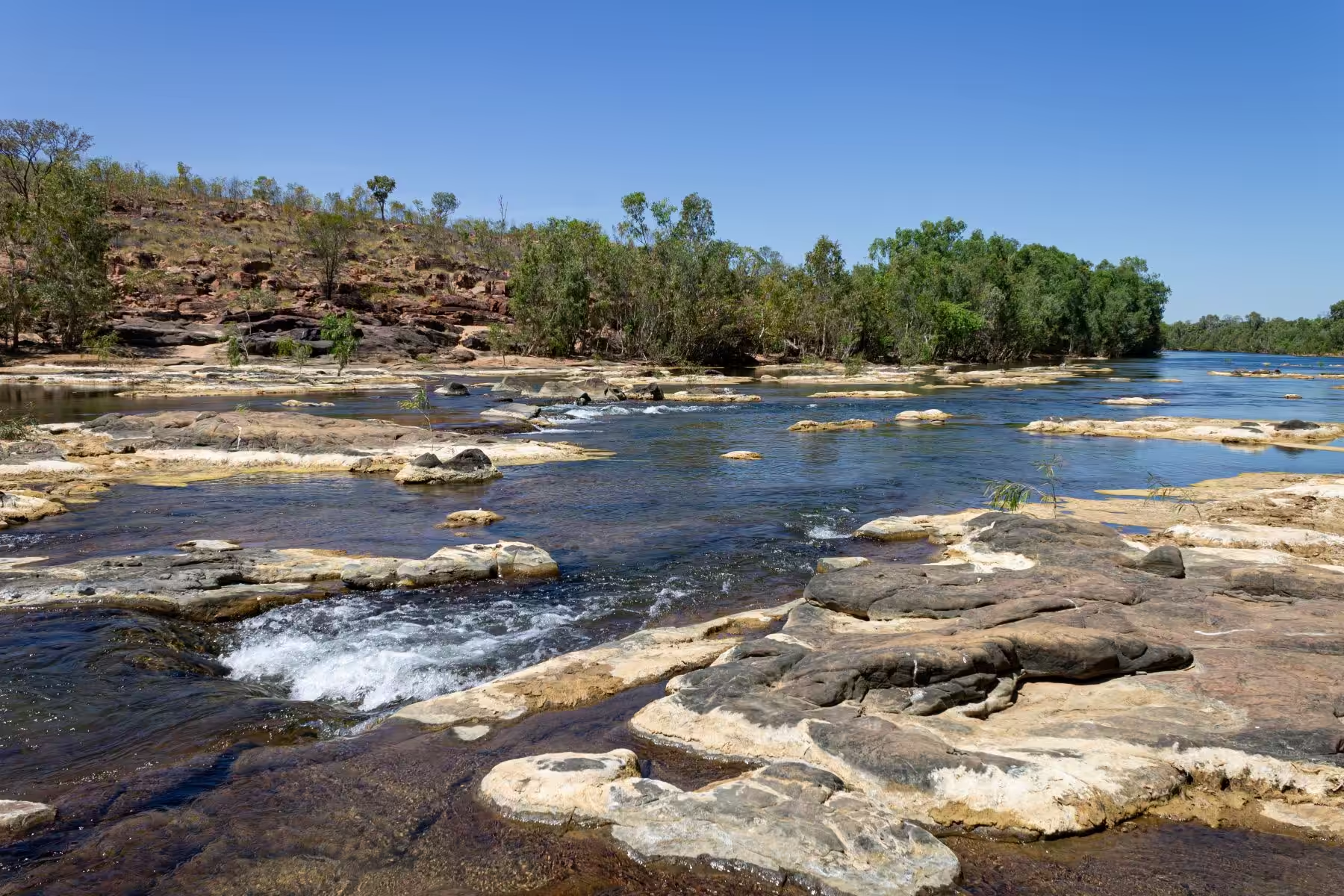
Back on the road, you’ll cross the Bynoe River that Burke and Wills followed up to the coast, and then the Flinders River which has a popular free campsite on the western side. The landscape changes once past Leichhardt Falls, a beautiful place to camp especially when the falls are flowing. From here, you reach the Savannah plains, flat and virtually treeless, and after a good season, covered in Mitchell grass.
Burketown is a small town located on the Albert River, with many offerings that include the old town bore that is still spewing out piping hot water. Don’t miss Yagurli Tours, which host a cultural tour, stargazing stories, a sunset cruise, a fishing charter or a hot air balloon experience. The Morning Glory Restaurant, Bakery and Café is a popular place to stop with RVers.
Heading towards Doomadgee, the striking landscape changes again with thick woodlands and termite mounds in amongst the spear grass. Be aware of wild brumbies as you pass Doomadgee and cross the Nicolson River. Hells Gate Roadhouse has limited powered sites but loads of unpowered sites, so you can spread out.
How did it come to be named Hell’s Gate? About 1km south of the roadhouse, the road passes through a gap known as Hell’s Gate. As the settlement grew in the Gulf, police would escort travellers only as far as the gap and from there, they were on their own until Katherine. These were harsh times, and the land was largely unexplored and considered to be dangerous, so the name is apt.
The bitumen runs out at Hells Gate, and it’s 50km west to the NT border. This section of dirt was in fantastic shape, although the dips and the water courses are very slow going, especially if you’re towing. Once across the grid signifying the border, don’t forget the Insta photo by the classic ‘Welcome to the NT’ sign.
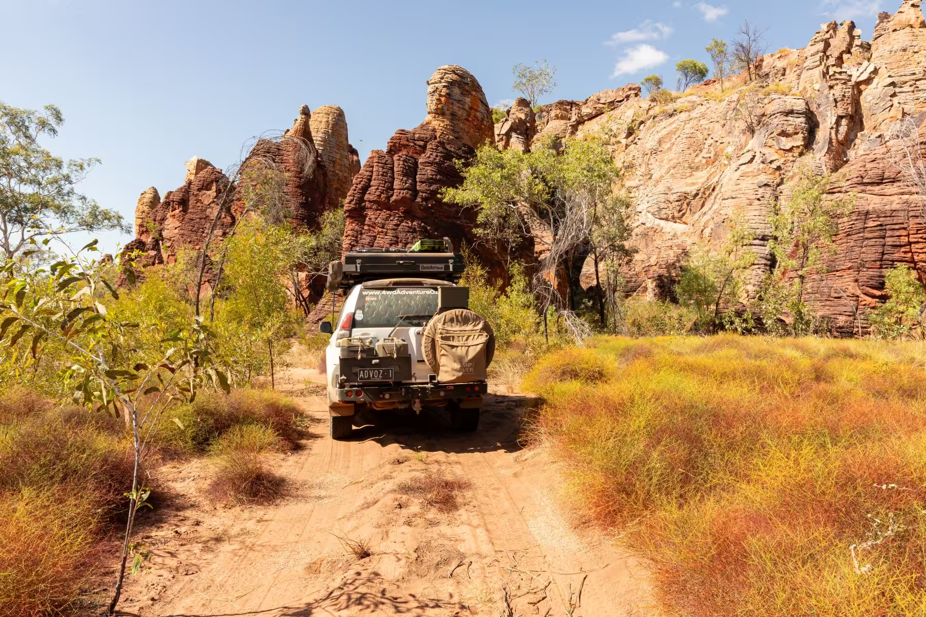
To the west of Wollogorang Station, some beautiful escarpments are a nice change. It’s very pretty as you pass through Echo Gorge, where natural springs flow across the road. The road gets rougher through the range with corrugations and stony sections. This is where reduced tyre pressures on the tow vehicle and caravan help with smoothing out the ride.
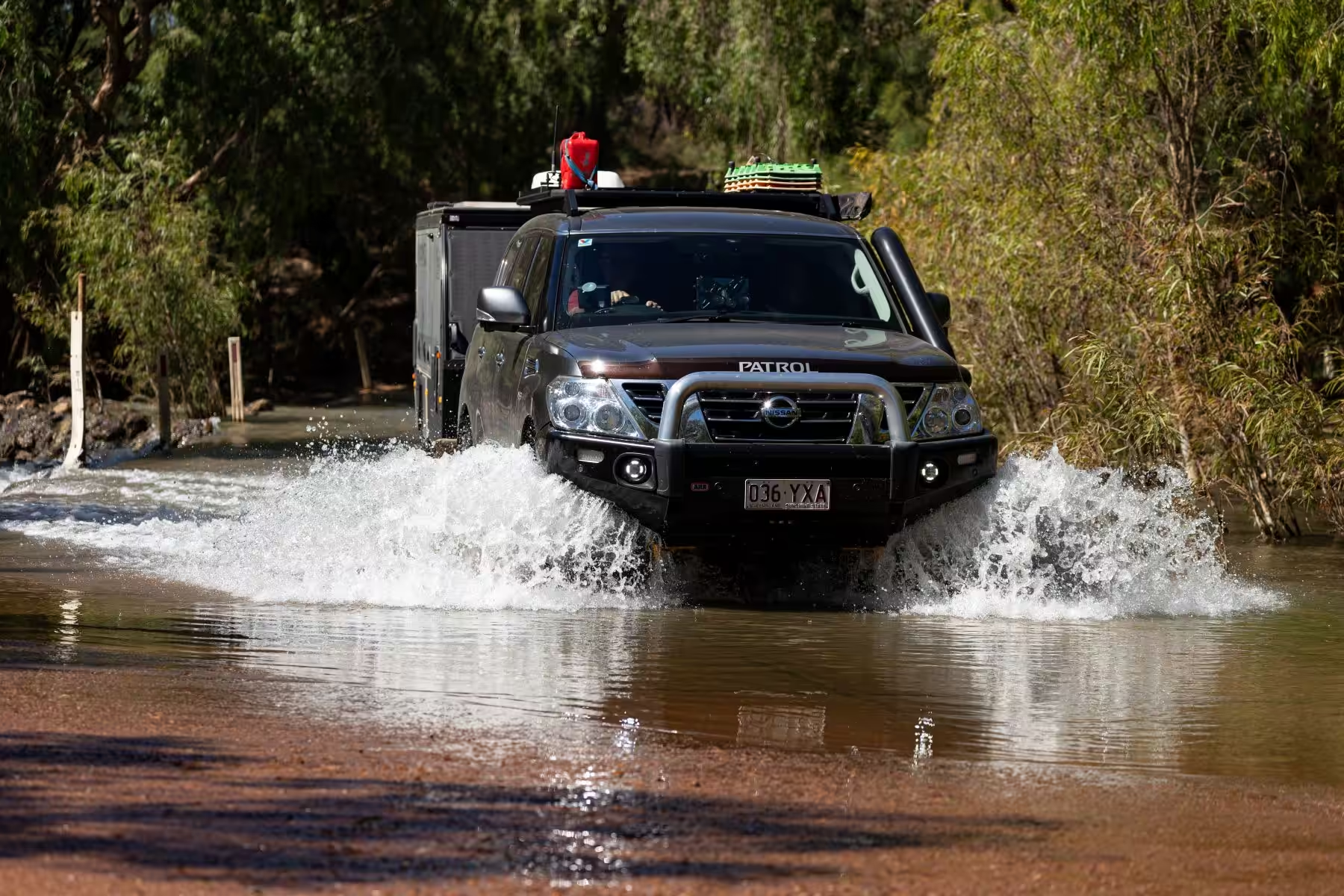
Once through the range, the Calvert River Crossing is beautiful and there is a free campsite on the western side of the river suitable for several RVs. The road condition worsens from here with long stretches of bone-rattling corrugations and bulldust. Enjoy the water crossings along this section. They aren’t deep or challenging but provide a break from the rough stuff.
The historic town of Borroloola is a remote community located on the banks of the McArthur River. The caravan park is neat and a nice place to spend a couple of days as you explore the area. Speak to Gail, and she will give you the good oil on what to see and where to go, including Waralungku Arts, the old Police Station Museum, the causeway at sunset, fishing at King Ash Bay or exploring the mini lost cities at Caranbirini Conservation Reserve.
Ryans Bend Road is an enjoyable drive to the southern section of Limmen National Park, with the 51km of gravel road reasonable going. Once on the Nathan River Road, the going is rough, with many creek crossings that are often steep and rough on entry and exit.
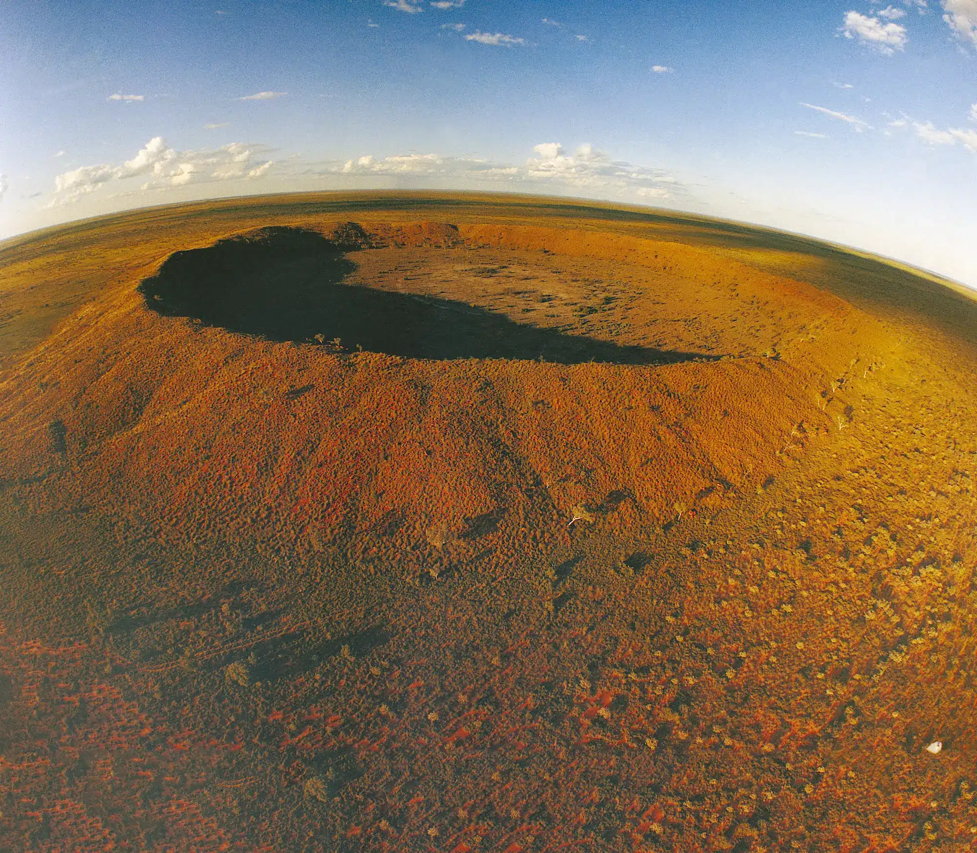
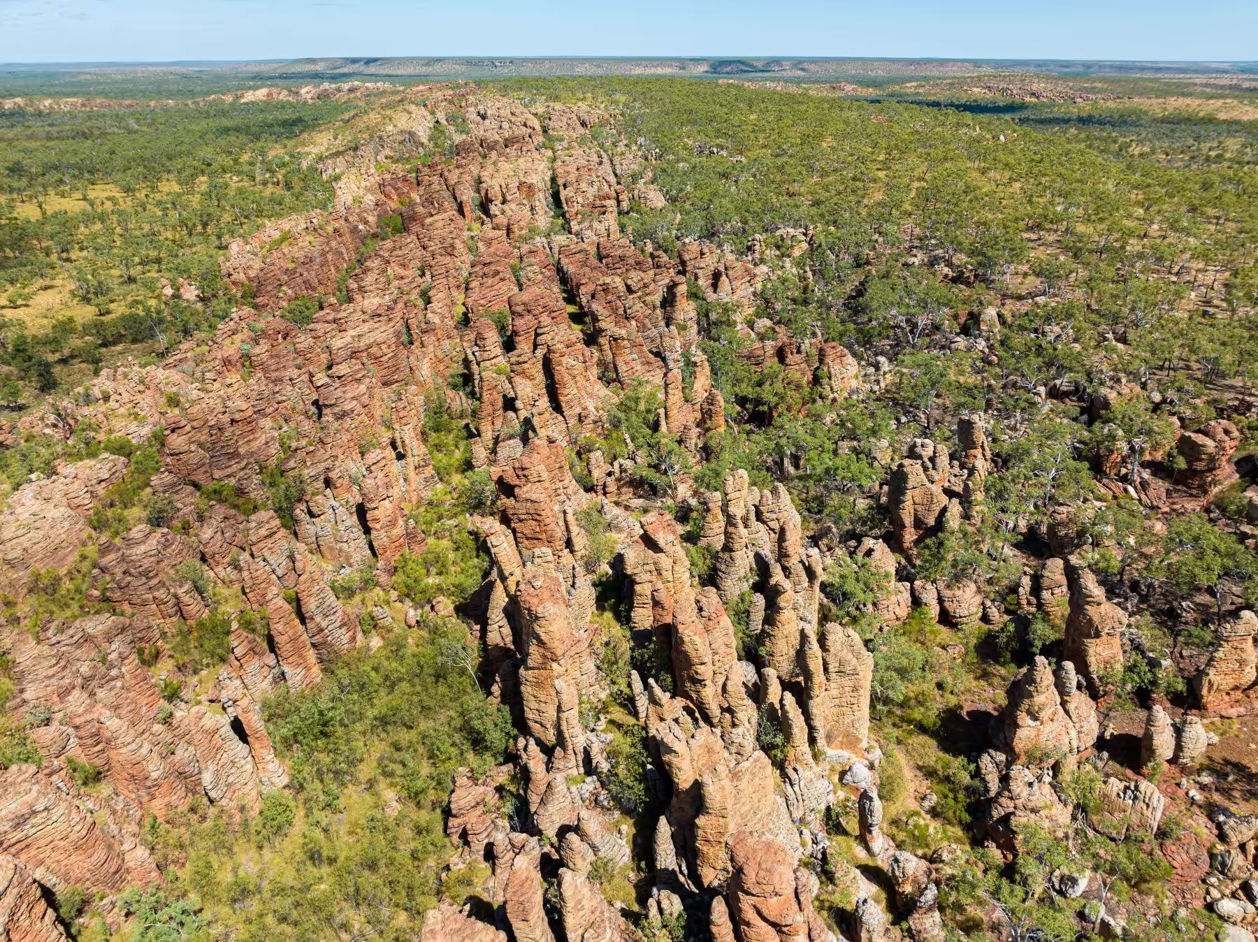
It’s 4km from the main road into the Southern Lost City, with camping and day visits, a drop toilet, tables and fire pits. There is a 2.5km loop walk through the sandstone outcrops. Keep an eye out for the short-eared rock wallabies that hang out in the overhanging rocks and ledges and the common crow butterflies in the cooler, shaded sections.
It’s 50km from the Southern Lost City to Butterfly Gorge, and the road conditions don’t change much. The campground is larger, with two drop toilet buildings and fire pits and tables at each site. The falls themselves would be stunning when flowing, but it was a mere trickle in July. The waterhole, with its flowering lily pads, was perfect to cool down and wash the dust off and is the only safe swimming hole within the park.
Access to the Western Lost City is via a 4WD only track (no towing permitted), and a code for the gate can be obtained from the nearby ranger station. This is an excellent drive that includes crossing the Limmen Bight River, keeping an eye out for water buffalo, and driving amongst the Lost City.
There are three more camping areas in the northern section of Limmen National Park, at Limmen River, Towns River and the largest one with most facilities, including showers, at Munbililla (Tomato Island). Before reaching Munbililla, find the St. Vidgeon Ruins and Lomarieum Lagoon. Camping isn’t permitted, but it is a lovely spot to sit and relax in the shade. However, beware of crocs! Roper Bar Store was closed at the time, but it’s worth driving 4km past the store to Leichhardts Crossing on the Roper River.
There’s more to Mataranka than just the thermal springs. There are a lot of historical things to check out, such as the replica Elsey Homestead from the movie ‘We of the Never Never’, Elsey National Park, 12-Mile Yards, and the old Mataranka sheep dip. You can camp in Elsey National Park beside the Roper River, and from there is the 8.2km return walk to Mataranka Falls.
This alternate section of the Savannah Way runs over 1200km from Normanton to Mataranka and is a mix of bitumen, gravel and sand with plenty of corrugations, bulldust and water crossings.
The towns of Normanton, Burketown and Mataranka have plenty of accommodation options, from caravan parks to free camps, and there are free camps beside several rivers along this section of the Savannah Way.
Limmen National Park has several campsites that must be booked and paid for before arrival, plus a NT Parks Pass is also required.
You should plan to drive the Savannah Way during the dry season from April to November, with the ‘cooler’ weather from June to August.