How to make the most out of WikiCamps
WikiCamps is a handy app that will help you trip plan and discover some awesome new locations on your Aussie travels.
Published on: 24 April 2023
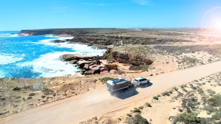
If you’re someone who likes camping and road trips and you haven’t downloaded WikiCamps, stop reading this right now and go download it! It’s hands down THE BEST app for planning and exploring on weekend adventures, a week long holiday or a round Australia trip.
I first discovered it in 2016 via a fellow traveller on a victorian coast road trip and I’ve been addicted ever since. Trust me, it will be the best 7 bucks you’ll ever spend!
When you open the app, the sheer mass of icons and dots and information can be pretty overwhelming, so the first thing you’ll want to get familiar with is the filters. Do you want to camp somewhere for free? With a dog? Somewhere with drinking water? With a swimming hole? You can tick ‘show’ or ‘hide’ on a whole range of different categories depending on what you need for your campsite. Once you’ve narrowed it down, it will be way easier to research your options and you won’t accidentally try driving to a 4WD only spot in a 2WD!
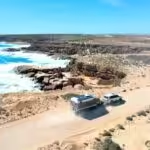
Of course it’s great for finding somewhere to sleep, but WikiCamps is also an absolute goldmine of other info great for Aussie road-trippers. They have day areas, points of interest (anything from a hike to a lookout to street art to a market to wineries), dump points, water points and info centres. I’ve had success finding really cool things to see and do, particularly with the points of interest. They show up as a different coloured icon on the map and there’s LOADS of them but if you use your filters, it can help you find some great little adventures and local sights.
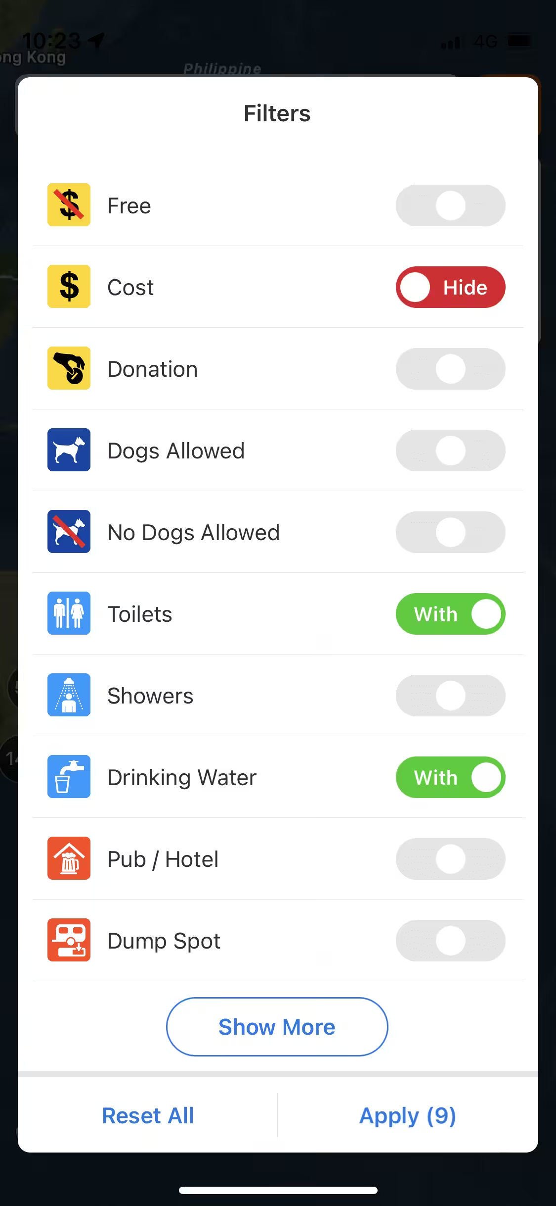
Now that you’re confident using the filters, you’ve probably got some common ones popping up. Sometimes you’re JUST looking for a toilet or a place to swim or a dog friendly camp. You can save various filter setting for quick, easy access later so you don’t have to scroll down and adjust them every time.
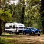
Arguably one of the best (my favourite anyway) feature of WikiCamps is the ability to create ‘trips’. This is perfect for function for when you have a road trip or holiday planned out and you want to visually map your route. I created one for our round Aus trip and it was so helpful being able to add things into the trip in advance because they were always easy to find later on.
As you create your trip, a little red line will start to connect the dots between your added locations. You can set locations to a certain date, add them at the beginning or end, or add them so they automatically slot in the most logical spot along the route you’re creating.
This is really helpful if you’re not familiar with an area, or your want to keep track of good recommendations for later on in your trip. You can also set your trip to follow roads on the fastest route, which is really helpful indicator of if something is actually close or you have to drive all the way around a mountain or cliff to get there.
To create a trip tap the HOME icon in the top right corner, tap on ‘trip planner’, then ‘change trip’ or ‘create trip’ if you haven’t made one yet. You then have the option to create multiple trips and switch between them. To add a site to your trip, click the three dots on the right hand side of a half screen site description, then ‘addto trip planner’ and then you’ll see a few options on how and where you’d like your site added. To edit your trip or see only sites in your trip planner, go back to ‘home’, ‘trip planner’ and you’ll see the map of your sites. For a list view, clock the top left dot point icon. As you move along in your route, you can move the progress bar down in the trip planner list view and the line will turn red along the route!
Basically it’s a planning tool, and a progress tracking tool all in one. And it looks super cool.
If you don’t necessarily have a specific trip planned, or your just using it for weekend getaways, liking sites is another nice way to keep track of places you want to go (or have already been to and loved!). Once you tap on an icon and the site appears on the bottom of the screen, you’ll see a little love heart on the image. Tap that, and it’s in your favourites! You can also favourite a location once you open the full description of the site.
Your favourites will then become little love heart icons on the big map and they’ll show up like that in all your trip planners. You can also filter so that your map only shows favourited sites, making them super easy to find!
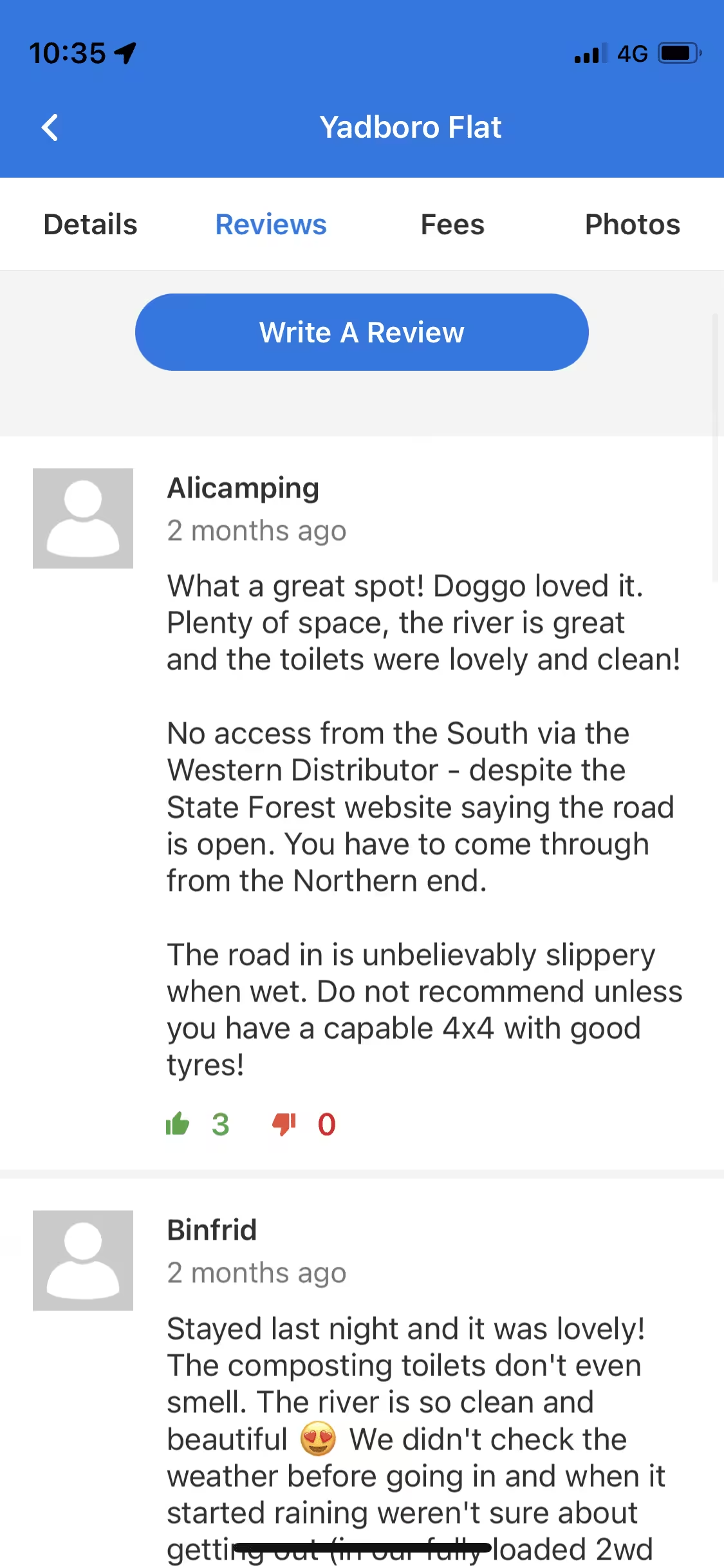
Often the main description of a site is quite limited, so I always look at reviews for campgrounds especially. They’re usually super helpful and sometimes very entertaining. People leave tips about the site, wether it was open or closed on their last visit, what the conditions are like, how clean places are and whether the road is suitable for certain types of cars. I’ve found that the start rating can be a little unreliable so the reviews often provide great insight to why somewhere might be good or not.
WikiCamps has an offline mode that can be downloaded within the app but this is only for the basic info. If you want to see images or reviews, I found that opening these up while in service, then not fully closing the app, can give you access to this info while you’re offline. This is awesome for when you’re going through a long period of no service and you’ve got lots of campsite options coming up but no time to read through all that info just yet. If you’ve already got a bunch of potential sites mapped out in a trip, just quickly open the reviews tab in each one then all the info will be there to browse as you go along!
WikiCamps will always show you your location on the map, even when out of service. This has been so helpful when out of range. I’ve even used it on hikes! Obviously this shouldn’t be relied upon as it’s not technically a navigation app, but if push comes to shove, you’ll always know roughly where you are. It also shows coordinates of your location which I’ve found helpful on those sad sad times when you break down on the roadside with only 3G reception!
If you’ve created a trip and set it to public, you can share it online. Perfect for if you’re chief organiser of a road trip and you’re sick of people asking “where are we going next?”. Go into the list mode in the trip planner, tap the three dots on the right hand side of the cover image, and share it like you would any other link!
WikiCamps is as great as it is because the information comes from the ground up. It’s a database of peoples photos, experiences and recommendations, out there for everyone to enjoy and get the most out of the outdoors. Do your bit by adding your own tips in reviews, giving places you love a good rating or even adding on new spots that aren’t on there yet.